ux design
Claude
side project
NYCPOPS
an alternative to the no-good-very-bad maps of privately owned public spaces in nyc
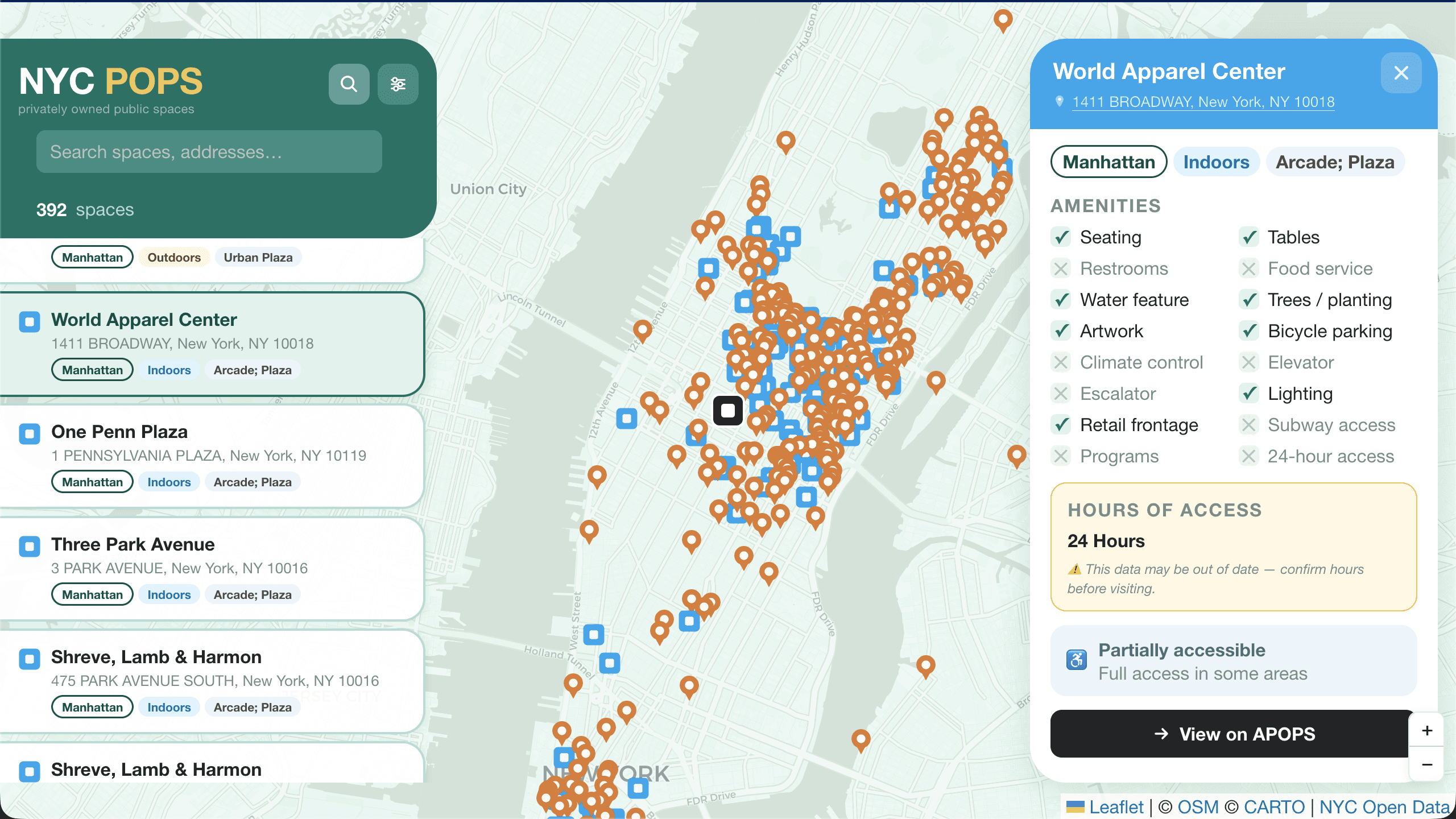
392 publicly accessible spaces hidden in plain sight across New York City that don't get used enough. using the NYC OpenData API, i created a single HTML file that presents a map with all locations. users can multi-select filters by borough, type, accessibility, and amenities, and a detail view for each space.
ux design
Claude
side project
NYCPOPS
an alternative to the no-good-very-bad maps of privately owned public spaces in nyc
392 publicly accessible spaces hidden in plain sight across New York City that don't get used enough. using the NYC OpenData API, i created a single HTML file that presents a map with all locations. users can multi-select filters by borough, type, accessibility, and amenities, and a detail view for each space.
392
privately owned public spaces exist aross the five boroughs
392
privately owned public spaces exist aross the five boroughs
392
privately owned public spaces exist aross the five boroughs
3.8 M
square feet of space that belongs to the public
3.8 M
square feet of space that belongs to the public
3.8 M
square feet of space that belongs to the public
0
ways to see all the POPS and their amenities on a map
0
ways to see all the POPS and their amenities on a map
0
ways to see all the POPS and their amenities on a map

context
NYC Privately Owned Public Spaces (POPS) is a little known New York gem of a program.
POPS are spaces open for public use, owned and maintained by private property owners in exchange for bonus floor area or zoning waivers.
I know POPS are around, but i dont have all 392 locations memorized and google maps kind of misses on this case. after being frustrated one too many times with the official POPS map, i made a better way to find and make use of the over 3.8 million square feet of public space available to New Yorkers

